Public Assets: City-Owned and Leased Assets
"The Sixth Borough"
City-owned and leased properties are underutilized. Twenty-two percent of city-owned and leased properties are classified as having no current use. Properties under this classification account for approximately 1,800 acres, an area more than double the size of Central Park.
Download Report
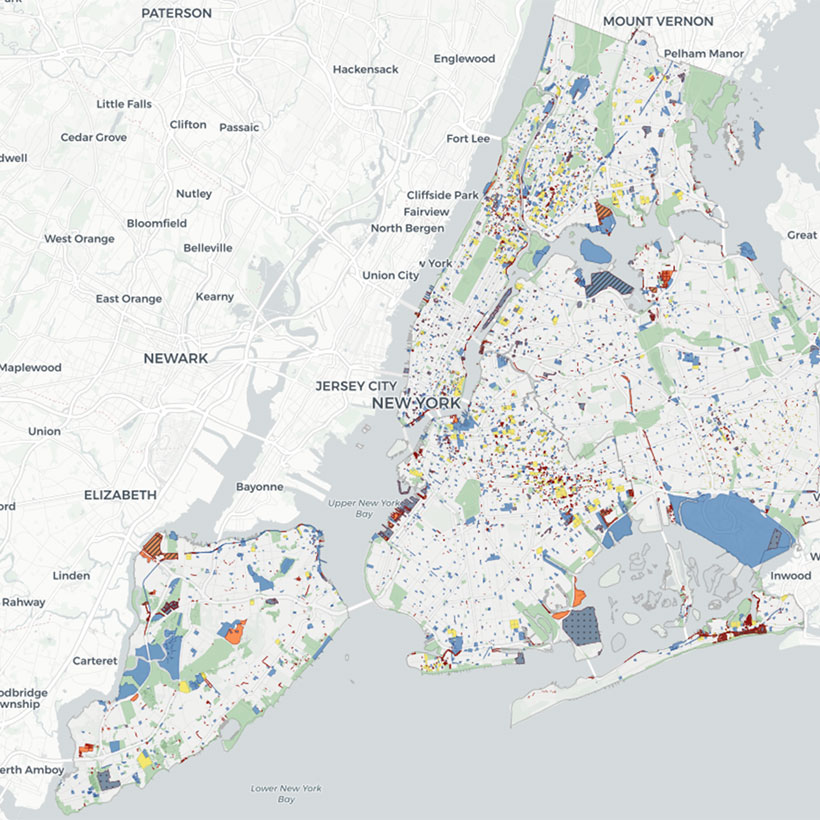
The City of New York manages over 14,000 properties covering approximately 43,000 acres across the five boroughs. Collectively, these properties encompass an area comparable to the size of Brooklyn. Given the extent of these public holdings, the information included in this online tool and report are designed to provide decision makers, planning practitioners, and the public with the necessary means to identify opportunities for improving, protecting, and utilizing city-owned and leased property.
The Municipal Art Society of New York (MAS) presents Public Assets: City-Owned and Leased Properties (Public Assets), a report and online mapping tool, to provide comprehensive land use, zoning, and geographic information derived from two city datasets, MapPLUTOTM and City Owned and Leased Properties 2014 (COLP). MAS envisions the release of Public Assets as the first step in an ongoing process designed to improve our public assets and contribute to a healthier, more dynamic, and inclusive New York City.
Public Assets presents a snapshot of how city-owned and leased properties relate to several key issues: the environment, infrastructure, landmarks, population, and neighborhood rezonings.
City-owned and leased properties are underutilized.
22% are classified as having no current use, accounting for approximately 1,800 acres, an area more than double the size of Central Park.
City-owned and leased properties are at a high risk for flood events now and in the future.
64% or 26,786 acres, are either completely or partially located within the 100-year floodplain. Sixty-six percent of the surface area will face high risk of coastal flooding hazards by 2050. Seventy-five percent are within the city and state-regulated coastal zone.
City-owned and leased properties protect wildlife.
~5% are either themselves designated tidal wetlands or partially within a tidal wetland.
City-owned and leased properties are toxic and cause pollution.
247 are fully or partially designated as New York State environmental remediation sites, 87 of which are enrolled in a NYSDEC State Superfund or Brownfield Cleanup program. Sixty percent are located within combined sewer areas.
City-owned and leased properties are accessible.
64% are within one-half mile of a subway station and 90 percent are within one-fourth mile of a bus stop.
City-owned and leased properties are historic.
665 all under the purview of the Landmarks Preservation Commission, 47 of which are characterized as having no current use.
City-owned and leased properties are located in low density, low income areas.
71% are located in census tracts less dense than the citywide average. 6,969 (totaling 15,511 acres) are located within census tracts with low median household incomes.
City-owned properties provide opportunities for redevelopment.
~8% Approximately eight percent are located in rezoning areas, including 1,864 individual parcels consisting of 2,500 acres. Twenty-two percent do not have a current use.

Help us continue our policy advocacy of behalf of New York City.
DonateRelated Initiatives
Related News + Reports