Major Questions Must Be Addressed in SoHo/NoHo Neighborhood Plan
Comments to the Department of City Planning
The SoHo/NoHo Neighborhood Plan is the first major land use decision to affect SoHo and NoHo in 50 years, and is poised to significantly transform the character of these iconic neighborhoods. The City goals to strengthen retail uses, promote mixed-uses, recognize the importance of the neighborhood’s art and creative culture, and encourage the development of affordable housing are laudable. The Draft Scope of Work (DSOW) must assess all factors to ensure that what is set in motion by the plan actually will achieve its objectives of net-new affordable housing rather than spur high-end residential growth that will displace economically vulnerable long-time residents and also incentivize threats to the area’s rich neighborhood character.
Download Testimony
Background
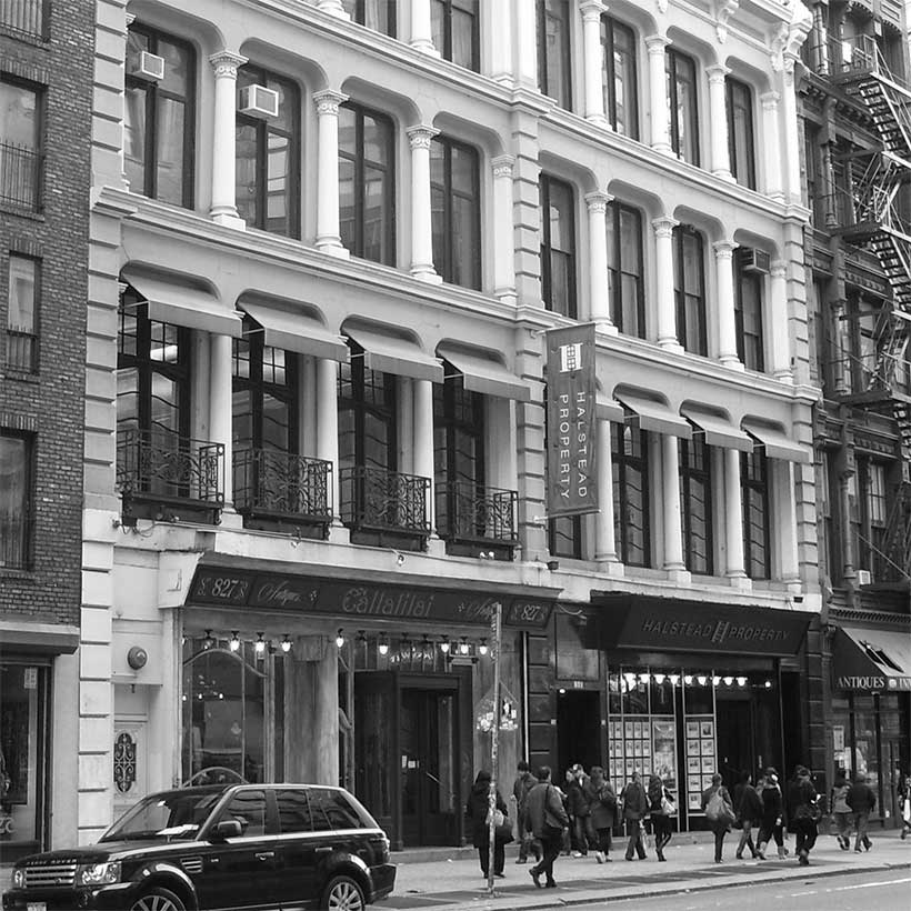
The M1-5A and M1-5B zoning districts were created in 1971 specifically for SoHo/NoHo. The zoning permitted the occupancy of certain industrial loft space, allowing conversions to Joint Living-Work Quarters for Artists (JLWQA), which remain the only as-of-right residential uses allowed.1 The zoning prohibits ground-floor retail and tenants are not permitted to occupy spaces larger than 10,000 square feet. Despite these regulations, retail stores have violated the zoning occupancy restrictions and many non-artists occupy space designated for certified artists. The City contends that the high volume of special permit and variance applications for new or converted retail space indicates the area has outgrown its zoning.2 Many opponents believe that the City’s lack of zoning enforcement has created the problem that the rezoning seeks to solve.
The SoHo/NoHo rezoning is unique among the City’s recent neighborhood rezonings. It is one of only two under the de Blasio administration that involves a predominantly white (78 percent), higher income area (median household income is $144,508 compared with $79,781 for Manhattan). Almost half of the area rental units are priced above $2,000 per month. In addition, SoHo/NoHo has four historic districts, comprising 80 percent of the rezoning area. These districts include the SoHo-Cast Iron Historic District; NoHo Historic District; NoHo East Historic District and a small portion of the Sullivan-Thompson Historic District. There is also a high level of home ownership in the area. Roughly 40 percent of the area’s housing units are owner-occupied, nearly twice the Manhattan average.
In January 2019, the City began Envision SoHo/NoHo, what it describes as a “robust public neighborhood process” to engage the community in workshops and information sessions. The City also formed an 18-member stakeholder advisory group consisting of residents, business owners, elected officials, City agencies, and other advocacy organizations to help inform the process. In November 2019, DCP issued the report Envision SoHo/NoHo, which the Draft Scope of Work (DSOW) claims synthesized public input and stakeholder engagement, articulating the following goals of the plan: replace outdated manufacturing districts with mixed-use regulations; introduce residential use and promote equity in housing; support arts and culture; and facilitate superior urban design and appropriate building form.
Project Description
The plan would create the Special SoHo/NoHo Mixed Use District over a 56-block, 146-acre project area. The Special District will contain eight subdistricts that will vary in allowable uses and FAR. Manufacturing districts will be rezoned to include contextual residential districts R7X and R9X. A new M1-6 manufacturing district will be added, along with a R10 residential district. Each district will also allow commercial and community facility use. Residential FARs would range from 6 to 12, commercial FARs would range from 5 to 10, and community facility FAR would range from 6.5 to 10.
The project will result in almost 1,700 new residential units, comprising 1.7 million square feet (sf) of floor area. The number of affordable dwelling units will range from 330 to 498. The project will also result in almost 60,000 gross sf of retail, including a supermarket, 51,508 sf of commercial space, about 26,000 sf of manufacturing space, and 19,000 sf of community facility space. The rezoning is expected to add approximately 3,200 new residents to the project area by the 2031 build year.
As a way to preserve the area’s cultural legacy, the plan would continue to allow JLWQA use and live-work arrangements under current zoning. It would also establish a volunteer option to allow JLWQA to transition to regular residential use with conditions that would support arts and creative industries. Under the plan, existing non-artist occupancy would be legalized, live-work would be more inclusive and reflective of modern needs, and the preservation and creation of affordable studio space would be supported.
Comments on the Draft Scope of Work
We look forward to the following comments being reflected in the Final Scope of Work (FSOW) and included in the Draft Environmental Impact Statement (DEIS).
Reasonable Worst Case Development Scenario
We question the reliability of the Reasonable Worst Case Development Scenario (RWCDS), which identifies 26 projected development sites and an alarming 57 potential development sites. The number of potential development sites is of primary concern because they are concentrated in the historic districts on sites occupied by existing buildings. The overall prospective development of the plan is significant. According to the DSOW, the development on potential development sites could result in over 1,500 additional dwelling units, 50,000 sf of destination retail and 15,000 sf of community facility space in addition to development projections in the RWCDS.
Under CEQR, projected development sites, those likely to be developed, are evaluated for impact. However, potential developments, are not. Potential development sites are less likely to be developed due to a variety of site conditions, such as size and shape. This is an important distinction because as we have seen with other neighborhood rezonings, potential development sites and unidentified sites often do get developed due to zoning lot mergers, development right transfers and additional zoning waivers and variances.
Public Disclosure
To provide a reliable evaluation of the full development impact under the proposal, the FSOW must reflect that all potential development sites will be evaluated for density‐related impacts, not just site-specific impacts. The DEIS must include a readable, easily understood spreadsheet with all of the projected and potential development sites including Borough Block and Lot number, size of lot, current and proposed FAR, and full development potential.
The FSOW and DEIS must include a project area map of the projected and potential development sites with the historic districts boundaries clearly defined.
Project Description
Retail and Ground Floor Character
The character of SoHo/NoHo is in part driven by the cultural landscape. The recent loss of local retail and cultural offerings, such as art production and exhibition space, has already altered these neighborhoods. The DSOW should include more explicit direction for assessing requirements for smaller storefronts to encourage the longevity of independent businesses and cultural offerings, whether private, such as art galleries, or non-profit institutions, especially on the side streets. The proposal currently fosters inappropriately large retail uses, and we recommend that it be limited to 6 FAR as per community input.
Affordable Housing
For a project that touts affordable housing as a primary benefit, the FSOW must reflect that the DEIS will disclose and evaluate the affordability levels being considered under the Mandatory Inclusionary Housing program. Furthermore, the FSOW and DEIS must also disclose how much new affordable housing is expected to be constructed within and outside of the four historic districts. An overall estimate of units does not indicate how and where the purpose and need of this proposed rezoning is being met.
Historic Resources
No city neighborhood rezoning has more potential to adversely affect historic resources than the SoHo/NoHo proposal. As mentioned previously, 80 percent of the project area is located within the boundaries of a historic district. Unfortunately, because the DSOW did not include a project area map showing the projected and potential development sites along with historic district boundaries, it is not possible to know the location of development sites in relationship to designation status. We find this omission to be counter to the purpose of CEQR as a disclosure process, leaving the public without an important analytical reference. We expect the FSOW and DEIS to include this map.
As of the most recent September 2020 MapPluto data, there are roughly 2.5 million sf of development rights available within rezoning area historic districts. The rezoning proposes more than 9 million sf of additional density, with more than 6 million sf concentrated within the historic districts. MAS is concerned that the development pressures to achieve full FAR build outs will trigger out-of-scale and inappropriate proposals within the historic districts beyond what is proposed for study in the DSOW. The statement that any development within historic districts would be subject to future review by the Landmarks Preservation Commission (LPC) provides little comfort given market conditions.
The DEIS must study the incremental increase in density that has taken place under the purview of the LPC within the area historic districts, and disclose how this an exponential change could be borne on designated properties.
Public Outreach
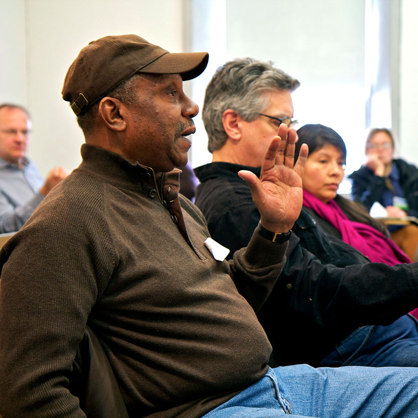
Despite the City’s community engagement efforts, many speakers during the public scoping hearing claimed the proposal reflects very little of the community input conveyed. If the plan is to succeed, it needs to strike the proper balance of meeting the City’s development goals and protecting the neighborhood’s most vulnerable residents and its unique sense of place. Mindful recent community and political challenges to neighborhood rezonings, the City needs to ensure SoHo/NoHo Neighborhood Plan reflects community voices. We recommend the City pay careful attention to the comments raised by the public during the CEQR and ULURP processes and make the necessary improvements that best work for the community and the City.
Conclusion
The SoHo/NoHo neighborhoods have transformed into vibrant mixed-use destinations since the original 1971 rezoning. We recognize the need for a planning approach that reflects these changes and appropriately points towards a future of equity and inclusion. The work ahead in the DSOW and the public review processes that follow must use all the tools at the City’s disposal to ensure that these changes can be achieved with great sensitivity to the unique historic and urban design character of these neighborhoods. Ultimately, for the SoHo/NoHo Neighborhood Plan to be successful it must protect the very characteristics that make this place special.
Notes
- The DSOW states that 30 percent of all SoHo/NoHo homes are listed as JLWQA use on certificates of occupancy.
- According to the DSOW, between 2000 and 2019, the City granted over 90 CPC special permits within the bounds of SoHo and NoHo, a portion of Community District 2, compared to those granted in all of Community District 1 (21) or Community District 3 (51).
Help us continue our planning advocacy on behalf of New York City.
DonateRelated Initiatives
Supporting New Yorkers to become stronger advocates for their neighborhoods

Related News + Reports