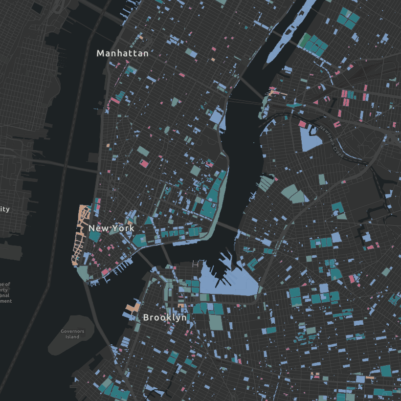
Public Assets Map
The "Sixth Borough," revisited
How many properties across the five boroughs are owned by the City of New York and how are they being used? The City Owned and Leased Properties (COLP) dataset from NYC Open Data can help us begin to answer that question.
The COLP dataset lists all properties citywide that are owned or leased by the City of New York. This update to the MAS Public Assets Map, originally published as a series alongside our 2016 Public Assets: City-Owned and Leased Assets report, draws from the latest COLP data and streamlines the information into a single map. It builds on the existing COLP data, which is only available as a points-based dataset, by visualizing the lots on which the properties are located and districts, from administrative ones to rezonings, that coincide. Mapping this data allows planners, elected officials, and the public to consider ways to address certain land use challenges and identify opportunities for community services, including new open space.
With the current housing crisis in mind, the prospect of utilizing public land for affordable housing has been recognized as a priority across levels of government, from State to Borough. Manhattan Borough President Mark Levine’s 2023 report Housing Manhattanites identified 170 underutilized public sites across the borough that could be used to construct new housing. Governor Kathy Hochul proposed constructing up to 15,000 units across unused state properties in her January State of the State address. Mayor Eric Adams’s “24 in 24” plan intends to pursue 24 affordable housing projects on unused, city-owned land by the end of 2024. At the same time, City Council Speaker Adrienne Adams has spoken of leveraging library sites and other city-owned land for housing.
When mapped to existing tax lots, an analysis of the dataset reveals that 86 percent of the properties in COLP are owned by the City of New York and occupy over 44,000 acres of land, comparable to the size of Brooklyn. A quarter of those sites are at least partially not currently in use by the overseeing agencies. Our intention in updating the Public Assets map is to encourage discussions around how the City’s land resources can be utilized for maximum impact.
Methodology
The map draws primarily from the City Owned and Leased Properties dataset published by the Department of City Planning (DCP). Because multiple City agencies may manage or be sited at a single location, for the purpose of visualization, properties were mapped to their associated tax lots according DCP’s Public Land Use Tax Lot Output (PLUTO) spatial data. All of the information in the map is derived from these publicly available datasets. For additional, specific information about a property, we recommend referencing the DCP’s Zoning and Land Use (ZoLa) Map, where you can search by address or BBL number to access building information (via BISWEB) and property records (via ACRIS). Information on City facilities and programs on site can be found on the NYC Facilities Map from DCP. If you have questions about how MAS has represented this information, please email us at planning@mas.org.
Related Initiatives