Further Analysis of the Proposed Bushwick Rezoning
Comments to the Department of City Planning
Bushwick is at a crossroads. While the neighborhood has been facing change for many years, it has grown organically into an eclectic community with diverse residents and businesses. However, the rezoning has the very real potential to tip the balance and homogenize a distinct mixed-use community.
Bushwick residents deserve a plan that prioritizes the needs of the existing community and their goals outlined in the Bushwick Community Plan, including the creation of additional and more deeply affordable housing, protections against residential displacement, and access to quality jobs. Although the City’s rezoning proposal incorporates some strategies with these goals in mind, the Municipal Art Society of New York (MAS) sees an opportunity for an alternative plan that achieves necessary growth in harmony with local needs.
Background
The proposed rezoning affects a 300-block, 1,300-acre area comprising the majority of the Bushwick neighborhood. According to the Draft Scope of Work (DSOW), the rezoning is estimated to result in a net increase of approximately 5,600 dwelling units, over 1.6 million square feet of commercial space, almost 300,000 square feet of industrial space, and nearly 250,000 square feet of community facility space. Future development is estimated to introduce nearly 18,000 new residents and 6,200 new workers to the area over the next 10 years.
Download Testimony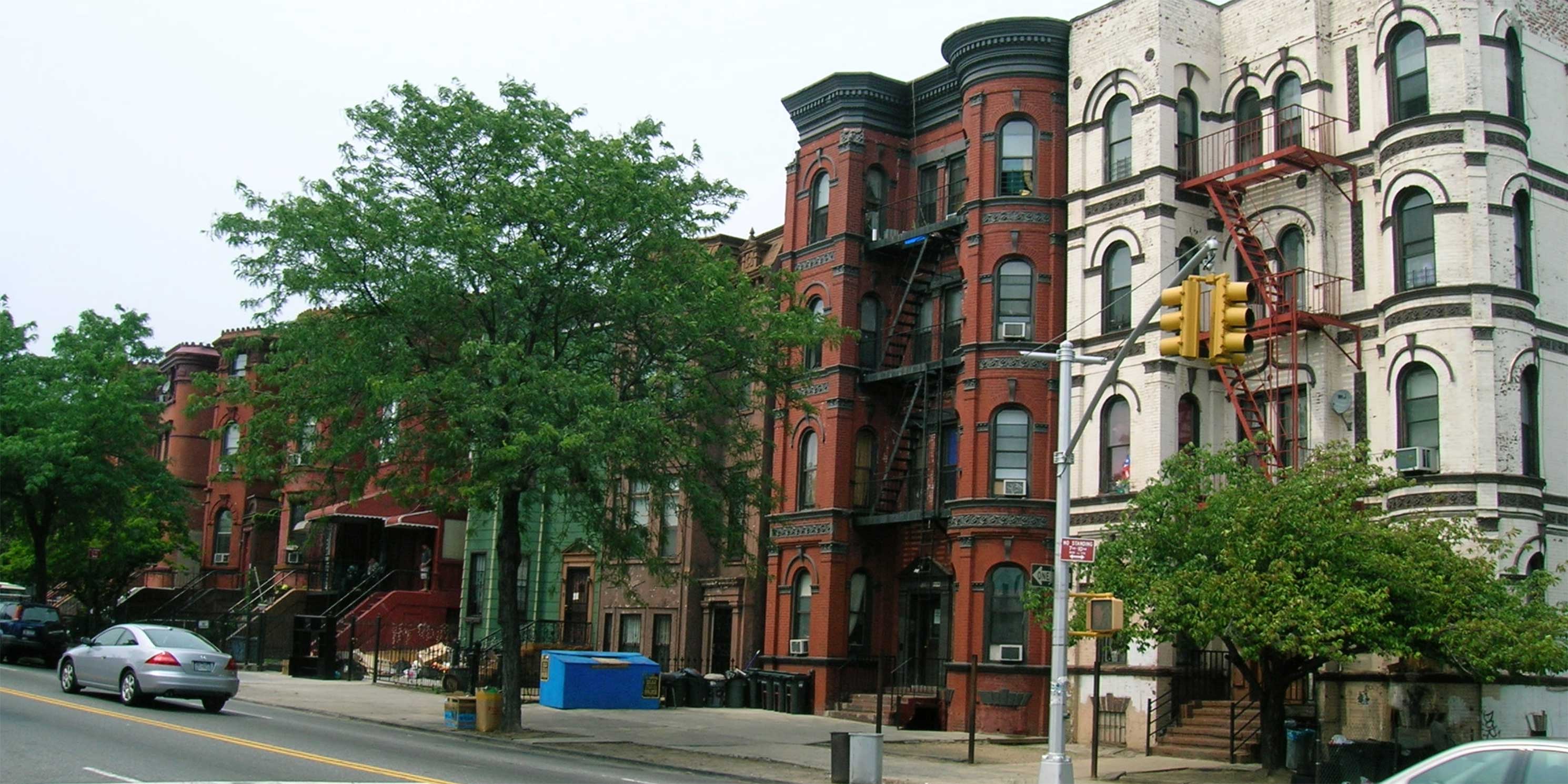
Reasonable Worst Case Development Scenario
The Reasonable Worst Case Development Scenario (RWCDS) in the DSOW identifies 167 projected development sites on 311 lots. The DSOW also identifies 39 potential development sites on 64 underlying lots. These potential sites are deemed less likely to be developed and are not evaluated for adverse impacts under CEQR guidelines.
The following comments and recommendations address specific issues that need to be properly disclosed in the Final Scope of Work (FSOW) and evaluated in the Draft Environmental Impact Statement (DEIS).
Comments and Recommendations
Because the DSOW only provides the general criteria used to identify development sites, the RWCDS in the FSOW and DEIS must include the criteria for why each lot was identified as a projected or potential development site. Additionally, the RWCDS methodology in the DSOW does not recognize the potential use of zoning lot mergers that could greatly increase redevelopment on blocks containing projected and potential sites. The DSOW lists 19 potential lots that are directly adjacent to projected sites. For example, the Foodtown supermarket at 1291 Broadway (Lot 29) is identified as a potential site, but is situated between three projected development sites that comprise almost the entire length of Block 3293. This suggests that not all development spurred by the rezoning will be identified and evaluated in the DEIS.
To capture the full extent of possible development under the rezoning and to optimize the accuracy of specific site projections, all 206 development sites should be included in the RWCDS. As MAS’s recent CEQR report shows, underestimations of future development under neighborhood rezonings result in unreliable and inadequate evaluations. In Buswhick, this can expose residents to the very impacts the community plan seeks to prevent, including residential and business displacement, overburdened infrastructure, and a departure from neighborhood character.
Another flaw in the RWCDS methodology is the assumption that 300,000 square feet of manufacturing space would be created under the rezoning. The assumption is predicated on the notion that commercial buildings in manufacturing and MX zones would include one floor of manufacturing space. However, there is no guarantee that 300,000 square feet of additional industrial space would be created under this scenario. The lack of reliability in the City’s estimations is a real concern. Therefore, MAS requests that the FSOW and DEIS disclose the methodology for the selection of sites on which this assumption is based, including the lot size criteria for each and a map of active industrial uses in the area.
Project Description
After five years of community planning efforts leading up to the current rezoning proposal, Bushwick residents deserve an effective and transparent public review process. The DEIS should include a clearly articulated rationale for why certain community-identified planning objectives were incorporated into the plan and others were not. To better align these objectives, we urge the City to engage in a more collaborative public conversation with Bushwick Community Plan creators and other local stakeholders before the release of the FEIS, beyond the scope of the customary CEQR and ULURP hearings. Transparency will be best served if the outcomes of these discussions are telegraphed clearly in the revisions to the DSOW that result.
Land Use and Zoning
Several land use measures of the rezoning align with the Bushwick Community Plan, such as the downzoning of mid-blocks and higher density development along the neighborhood’s transit corridors. However, the City’s plan maps residential uses in existing manufacturing zones, a major divergence from the community’s request for the protection and enhancement of industrial space and associated jobs.
The current plan introduces medium-density mixed residential-industrial zoning on 21 blocks currently zoned M1-1. The allowable FAR would increase from 1.0 to 2.0 for commercial and industrial uses and up to 5.6 for residential uses under Mandatory Inclusionary Housing (MIH). As the market tends to favor high-end residential and commercial uses, they have the potential to proliferate and displace other uses. Mandatory inclusion of industrial space in new developments would protect manufacturing businesses, strengthening the ability of many Bushwick residents to thrive in their neighborhood.
Land use changes proposed for the industrial blocks along the western boundary of the Bushwick rezoning are not isolated from the rezoning of the North Brooklyn Industrial Business Zone (IBZ), which is expected to begin in late 2019. The IBZ rezoning intends to create a “Growth District” immediately adjacent to Bushwick’s M-zones, where increases in FAR ranging from 1.0 to 5.0 would facilitate the growth of “creative and tech-driven jobs in office-based and industrial sectors.”1
It is critical that land use changes to industrial land under the Bushwick rezoning preserve existing manufacturing and industrial businesses while also creating opportunities for emerging industries. We recommend that the FSOW and DEIS land use analysis study area be expanded to include the North Brooklyn IBZ to ensure that changes to Bushwick’s industrial blocks are evaluated cumulatively with those of the neighboring IBZ. Not only would this paint a more accurate and comprehensive picture of potential impacts on specific industries, it would also inform effective mitigation measures and help avoid the loss of the manufacturing job base south and west of Newtown Creek.
Socioeconomic Conditions
The level of housing affordability under the rezoning must represent the income levels of current residents and prevent further displacement of low-income families. In an area with a median household income of $48,000 – compared with New York City’s AMI ($85,900) for a family of three – and where 54 percent of households are rent burdened, Bushwick needs the deepest level of affordability provided under MIH.
The issue of affordability goes beyond displacement of residents and businesses. Higher living expenses associated with the influx of 5,613 market rate units has the potential to fundamentally transform Bushwick’s vibrant immigrant and artist communities. Therefore, the FSOW and DEIS must identify and evaluate a level of affordability under MIH that is representative of the community. This can be accomplished by introducing MIH units at 40 percent AMI more broadly throughout the study area.
Data
The CEQR Technical Manual requires the analysis of broad socioeconomic trends and impacts on the study area level. However, disaggregating study area census tracts reveals the true story of disparate socioeconomic dynamics within Bushwick. For example, Census Tracts 421 and 423 are adjacent to one another but represent very different economic realities. Households in Census Tract 421 have a median income of $41,250, a third less than the $62,750 median income for households in Census Tract 423.2
Variations in household income have also grown over time. For instance, the median household income in Census Tract 431 more than doubled from $31,152 in 2010 to $62,625 in 2017. Meanwhile, Census Tract 403 saw a 16 percent decrease in median household income, from $42,897 in 2010 to $36,116 in 2017.3
Race
In a recent report, MAS uncovered major demographic shifts catalyzed by the rezonings of Long Island City and Downtown Brooklyn.4 These neighborhoods became significantly more affluent and white, while the population of black and Hispanic residents stagnated.
More recently, the racial impact of rezonings and their role in displacing minority households has been heavily scrutinized by Public Advocate Jumaane Williams and Council Member Rafael Salamanca.5 This is a paramount concern in Bushwick, where 57 percent of the population identifies as Hispanic and 30 percent as black. These residents are disproportionately in low-income households. Hispanic and black households have median earnings of $39,000, which is $23,000 (37 percent) below that of white households.
With the introduction of 5,613 market rate units and the expected increase in housing costs, the proposed rezoning has the strong potential to exacerbate existing socioeconomic and racial disparities. Concentrations of households on the western edge of Bushwick are predominantly white, higher-income residents. In comparison, the majority of households in the census tracts bordering Broadway are largely low-income, minority residents. Here, over 1,745 new residential units are projected for construction, of which only a quarter will be affordable. Even the deepest MIH levels will be out of reach for most residents in these tracts. Moreover, across the entire rezoning area, MIH options of 60 and 80 percent AMI are unattainable for the majority of minority households. This severely limits their ability to remain in Bushwick long term.
To optimize the accuracy of the socioeconomic conditions analysis – including racial impacts – the DEIS must evaluate income and racial trends on a census tract level. This would improve estimations of indirect residential displacement and ensure that MIH options reach all groups at different income levels, including extremely low-income families.
Direct Business Displacement
The DEIS should identify opportunities for owners of displaced businesses under the rezoning to relocate or establish new businesses within the study area, either in newly created or existing commercial spaces. To achieve this, MAS recommends that the floorplate size of new commercial development be minimized to ensure that costs are accessible to small businesses. A requirement for a percentage of smaller (under 1,500 square feet or similar threshold) retail spaces should be evaluated to replicate the existing level of ground floor activity, business density, storefront design, and diversity of retail leasing options.
Indirect Business Displacement
The assessment of indirect business displacement must examine the impacts of increased rents, tenant harassment, changing retail demands in neighboring districts, and increased development pressure. In a neighborhood with attractive commercial building stock where local street art and murals define the retail environment, Bushwick is undoubtedly prone to commercial development speculation, which also affects rental rates.
The DEIS should include a detailed assessment of indirect business displacement due to market saturation. The assessment should include a survey of soft site commercial property owners, which would reveal whether the area’s high retail vacancy rate (15.2 percent, compared to an average of 5.6 percent in 72 other city business improvement districts6) is a symptom of speculation or factors such as lack of market demand or poor storefront conditions. Property owners warehousing retail space in anticipation of redevelopment opportunities may also lead to disinvestment on local retail streets.
According to the DSOW, the project would result in less than 200,000 square feet of regional-serving retail (the threshold under CEQR guidelines) in the study area and would not warrant further analysis. However, given the volume of expected retail under the proposed actions and the lack of guidelines to limit the size of those spaces, it is difficult to determine that less than 200,000 square feet of expected new retail will be regional-serving. The DEIS should consider emerging trends for regional-serving retail to occupy smaller footprints in urban environments, the availability of well-suited sites, and the spending power of the neighborhood suggested by the leakage identified in the 2018 Bushwick Commercial District Needs Assessment.
Adverse Effects on Specific Industries
The current plan relies on zoning alone to encourage investment in commercial and industrial development, as well as job growth. However, the plan should outline both incentive and mandate structures to ensure the inclusion of industrial spaces in new commercial development. To retain and attract industrial and manufacturing uses, the DEIS should assess the financial feasibility of mixed-use industrial building typologies and identify tools needed to mitigate increased market pressure and site acquisition costs. These include City programs like the Industrial Developer Loan Fund, designed to provide gap financing for industrial projects, or the Commercial Lease Assistance Program, intended to assist businesses with legal services for securing, extending, or amending a commercial lease.
Open Space
With less than 40 acres of open space, Bushwick has only a fifth of the acreage available to the average New Yorker and only about a tenth of the recommended goal under CEQR guidelines. According to the Bushwick Community Plan, much of the neighborhood’s existing green space is also in poor condition, especially smaller spaces like Fermi Playground and Heckscher Park. Taking into account the projected population increases, nearly 70 acres of new parks and open space would need to be created just to maintain the current residential open space ratio.
To accommodate the influx of thousands of new residents and workers, Bushwick desperately needs a comprehensive plan to upgrade and significantly expand open space, as well as offer protections for its 14 community gardens. The ability of existing and new green space to offset urban heat island effects from increased development should also be considered. The DEIS should outline specific strategies for adding quality parks and playgrounds that includes Parks Department and community input into their design and placement. The analysis must pay particular attention to the linkages between open space and the park deserts at the edges of the rezoning area boundary. Soft sites, City-owned land, and other community-identified sites should all be considered as potential new park space.
MAS questions the criteria used to determine access to neighborhood open space. This is especially important because 72 percent of identified passive open space considered in the analysis is Evergreens Cemetery, which can only be accessed at the very eastern edge of the rezoning area. Given that many, if not most, neighborhood residents and workers may not actually use a cemetery for passive recreation, the open space ratio in the DSOW is in fact an underestimation of the green space in the rezoning area. MAS requests that the DEIS evaluate open space access by providing an analysis that excludes the cemetery.
Historic and Cultural Resources
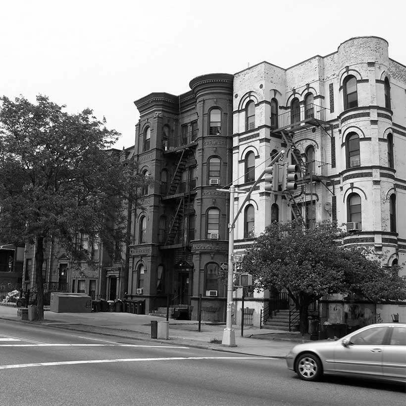
Bushwick contains architecturally significant blocks and buildings that are central to New York’s legacy of immigration and economic opportunity. These properties represent some of the last tangible connections to Brooklyn’s thriving brewery industry and the German community who influenced the neighborhood’s development. Bushwick is also home to fine examples of middle-class housing and neighborhood institutions that deepen our connection to past generations of Brooklynites.
Within Bushwick, MAS identified three buildings on the National Register and 297 buildings as contributing to a National Register district. They include:
- South Bushwick Reformed Protestant Dutch Church Complex
- Eighty-Third Precinct Police Station and Stable
- Wilson Avenue Subway Station
- Willoughby-Suydam Historic District (50 contributing buildings)
- Cypress Avenue West Historic District (247 contributing buildings)
In addition to this list, the DEIS field survey of historic resources should include the individual buildings and districts proposed by the community for Landmarks Preservation Commission (LPC) designation. Any buildings that appear eligible for the State or National Registers or designation by LPC should also be considered. All known and potential historic resources must be identified in the study area, not only those that could be directly impacted.
Study of contextual impacts should also include an examination of the change in neighborhood character due to the conversion of industrial and manufacturing buildings into residential developments, as required by the CEQR Technical Manual. The results of the DEIS survey should be given to both LPC and the State Historic Preservation Office so that they may determine the eligibility of the resources. Both of their determinations should be included in the DEIS.
Water and Sewer Infrastructure
Bushwick and its surrounding neighborhoods adversely contribute to the heavily polluted Newtown Creek. The entire rezoning area falls within the sewershed of Combined Sewer Overflow NCB-015, at the head of Newtown Creek, which is responsible for an estimated 570 million gallons of discharge per year.7 The U.S. Environmental Protection Agency (EPA) estimates that as little as 0.4 inches of rain in this area can cause CSO overflow from the NCB-015 outfall8, a trend that is expected to increase as New York becomes more humid and wetter due to climate change.9
The addition of thousands of new residents and workers to the area will inevitably increase the frequency of CSO overflows into Newtown Creek. Efforts to remediate Newtown Creek–a Superfund site and one of the most polluted waterbodies in the country–will be quickly undone if additional stormwater and wastewater impacts are not properly accounted for in the rezoning plan. To remedy this situation, DCP must work with DEP, DEC, and the EPA on a CSO mitigation plan for the rezoning area and coordinate this plan with the EPA Superfund cleanup for Newtown Creek.
Hazardous Materials
Bushwick has a long history of industry and heavy manufacturing, and a toxic legacy, the full extent of which is still unknown. With the proposed conversion from manufacturing to mixed use, MAS is concerned about the environmental threats to resident health. As such, it is vital that the City engage in extensive review of all rezoned lots and prepare remediation plans for affected areas.
The NYC Office of Environmental Remediation (OER) identifies seven NYS Open Petroleum Spill Locations, one Chemical Bulk Storage Site, and one NYS Hazardous Waste Site in the rezoning area. Moreover, although the surrounding neighborhoods (large areas of which have already been rezoned) list hundreds of current E-designations, the Bushwick rezoning area lists only seven. Since investigation and establishment of E-designations usually result from rezoning actions, it if fair to assume that known levels of contamination in Bushwick are an underestimation. DCP and OER must thoroughly investigate and include in the DEIS a comprehensive list of all possible sites in the rezoning area that meet the criteria for E-designation. This would ensure that environmental requirements established during the rezoning process are fully addressed in any new development.
Furthermore, the Wolff-Alport Superfund site on the northeastern edge of the rezoning area border continues to affect Bushwick residents, but is not mentioned in the DSOW. The site is a former nuclear material processing facility that has contaminated the soil, groundwater, and sewer system. While the EPA has completed the bulk of the remedial design and full remediation is expected to be completed in late 2021, the cleanup itself has not yet begun. It is critical that DCP work with the EPA to completely remediate the site before rezoning-related development begins. DCP must also investigate the ramifications of the rezoning if the remediation is not completed within the timeframe indicated by the EPA, and address this scenario in the DEIS Public Health evaluation.
Mitigation
MAS’s recent CEQR report revealed consistent deficiencies in how the City identifies and implements mitigation measures to address adverse environmental impacts of large-scale neighborhood rezonings. Therefore, we urge DCP to identify specific mitigation measures in the DEIS approved by the responsible City agency. This will allow the public to comment prior to the release of the FEIS.
In addition, the FSOW and DEIS should include a provision that written commitments for mitigation be addressed in the FEIS. It should include the type and location of the specific measures, implementation schedule, and specific procedures by which the mitigation would be monitored and tested for effectiveness. We also expect follow-up memoranda by DCP at designated times during the rezoning build year period that inform the public of implemented mitigation measures. Finally, we urge the City to include fulfillment of mitigation commitments for projected and potential development sites as a condition for granting certificates of occupancy once sites are ready for redevelopment.
Alternatives
The DEIS must include a robust alternative that evaluates the land use objectives identified in the Bushwick Community Plan so that the potential impacts and outcomes of the community’s plans can be exhaustively compared to the City’s proposal.
The alternatives section should also outline and evaluate a separate scenario in which residential development would be more heavily weighted over industrial and commercial uses in the proposed M/R zones. This would provide an additional level of predictability in the event that market conditions change and the anticipated mixed-use development scenario does not occur as projected.
Conclusion
Neighborhood change is inevitable, and nowhere is this more apparent than in Bushwick. Organic growth has created an eclectic, mixed-use neighborhood with a vibrant street life and a diverse community of residents and businesses.
The current rezoning plan considers Bushwick through the limited lens of development potential and opens up large portions of the neighborhood for the market to dictate its future. What Bushwick needs is a balanced community-informed plan that considers a type and scale of growth that is appropriate and desirable for the quality of life of current and future residents.
Notes
- North Brooklyn Industry & Innovation Plan, Department of City Planning, November 2018, p.xii.
- 2017 ACS 5 YR
- 2010 and 2017 ACS 5 YR
- https://www.mas.org/news/a-tale-of-two-rezonings-ceqr/
- https://citylimits.org/2019/06/25/nyc-housing-racial-impact/
- Bushwick Commercial District Needs Assessment, NYC Department of Small Business Services, 2018, p.6
- https://openseweratlas.tumblr.com/greytogreen#Bushwick
- https://openseweratlas.tumblr.com/greytogreen#Bushwick
- https://www.dec.ny.gov/energy/94702.html
Help us continue our planning advocacy on behalf of New York City.
Donate