City Environmental Quality Review Reform
Exploring ways to improve the City's CEQR process
Starting in 2018, MAS has led the charge to improve City Environmental Quality Review (CEQR), New York City’s process for disclosing and evaluating impacts of discretionary land use decisions such as neighborhood rezonings and large-scale developments before they can be approved. Since 2020, MAS has teamed with Regional Plan Association and NYU’s Guarini Center on Environmental, Energy, and Land Use Law as part of the CEQR Reform Coalition to examine ways to advance CEQR evaluation methodology, mitigate impacts of development, and increase transparency. This page presents an overview of our CEQR reform work.
SITE x SITE (2023)
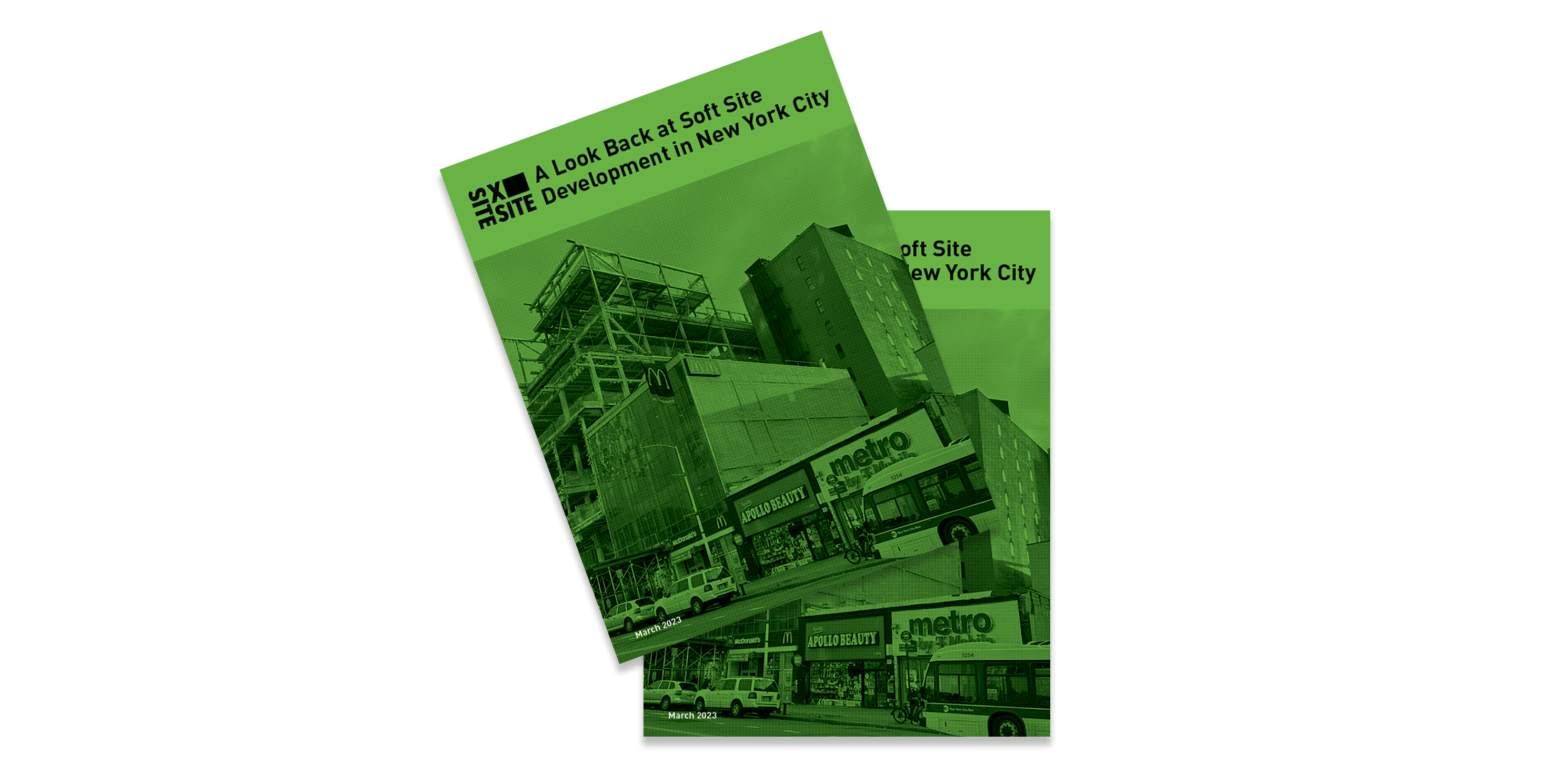
SITE x SITE is an unprecedented citywide study by the Municipal Art Society and Regional Plan Association of how soft sites have been developed over time. Soft sites are sites identified and evaluated in CEQR where development is likely to happen following the approval of a neighborhood rezoning or large-scale development. A reliable soft site analysis is critical to a comprehensive analysis of the full effect a rezoning may have on a neighborhood, particularly when it comes to public schools, transit, traffic, open space, socioeconomics, and other important factors. When soft site identification is incomplete or faulty, communities are often left with unintended consequences such as over-utilized schools, crowded subway stations, displaced residents and businesses, and a lack of public open space.
Please explore SITE x SITE’s user-friendly mapping tool that shows how soft sites have been developed throughout the city and how they relate to key regulatory and land use factors such as historic districts, the coastal zone, and recently rezoned areas SITE x SITE also includes a detailed report that covers methodology, important findings, case studies, and recommendations for improving CEQR evaluations. Here’s a two-page project brief summarizing the findings in the report.
As part of the SITE x SITE initiative and the CEQR Coalition’s work, NYU’s legal article Impact Fees in New York City? Legal Authority, Constraints, and Potential Options examines the legality of imposing impact fees to address development in New York City.
Up to the TASC (2021)
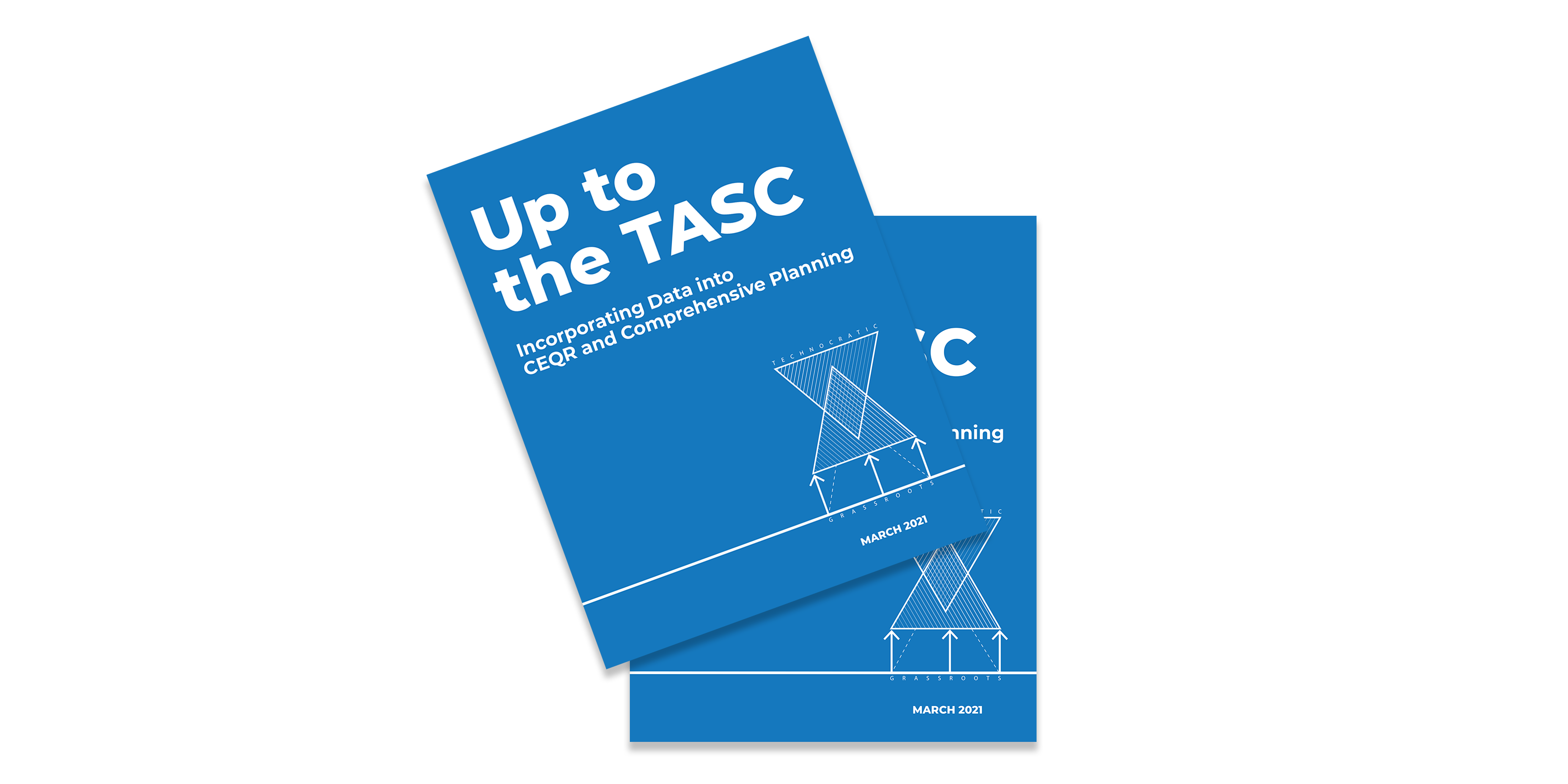
Technical Advancement and Support of Comprehensive Planning and CEQR Reform (TASC), launched in 2019, was the first project undertaken by the CEQR Reform Coalition. As outlined in the project’s companion report Up to the TASC: Incorporating Data into CEQR and Comprehensive Planning, the Coalition sought to improve CEQR by identifying an expanded list of factors that affect development. The Coalition created an index of 45 built environment and social vulnerability factors. The factors were incorporated into a framework for a future comprehensive mapping tool that would allow users to formulate future development scenarios at the neighborhood level. TASC also supports our ongoing advocacy on comprehensive planning and strengthening community-led planning.
TASC also includes NYU’s report Reforming CEQR: Improving Mitigation Under the City Environmental Quality Review Process, which draws upon existing literature and case studies of several CEQR evaluations and lays out broad goals for reforming the City’s approach to mitigating impacts of development following major rezonings.

A Tale of Two Rezonings (2018)
In A Tale of Two Rezonings: Taking a Harder Look at CEQR, MAS conducted a retrospective analysis of the CEQR development projections and impact evaluations of the rezonings of Long Island City (2001) and Downtown Brooklyn (2004) to see how they measured up to the actual development that occurred in these neighborhoods. The CEQR evaluation for Long Island City’s rezoning projected a mere 300 new dwelling units would be built. However, as of 2018, the rezoning produced almost nine million square feet of new residential development, adding more than 10,000 new units to the area. The CEQR evaluation for Downtown Brooklyn’s rezoning predicted the construction of 979 new residential units by 2013, when in fact, more than 3,000 new units had been constructed, with an additional 5,000 built since. The City’s miscalculations were not trivial. The larger issue is the failure of the City to anticipate and plan for the real world results of zoning changes in these two neighborhoods. The mitigation measures that were proposed in the FEIS addressed adverse impacts from a development scenario that never happened, and the environmental impacts that did occur were largely never evaluated.
Follow MAS:
MAS members and partners are crucial to everything we do. Please consider contributing to MAS and joining our community of advocates.
Support UsContact a staff member about this initiative. planning@mas.org >
Help us continue our planning advocacy on behalf of New York City.
DonateRelated News + Reports


Related Initiatives


Establishing the Zoning Resolution of 1916
Following years of advocacy by MAS, political reformers win approval of the Zoning Resolution of 1916, the first citywide zoning code in the country.
View Our Full History